(Pegan Cove Park is special, leased by the Town of Natick from Cochituate State Park. In December 2000, it was the first of many Natick Conservation Areas to receive a trail map (available, with supporting text, at the Natick Conservation Dept. or at the Natick Morse Institute Library). Dick Miller, one of the mapping volunteers, provides this expanded version of that hand-out's wording.)
The Area: |
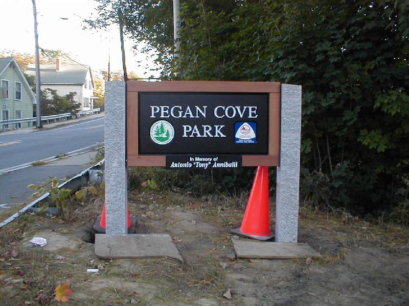
| New entrance sign on Washington Avenue (Oct. 2001) |
Additional Allowed Uses/Restrictions:
Permitted: Hiking, walking leashed
pets, biking (defer to pedestrians), fishing (but do not dig for bait),
picnicking; skiing and snowshoeing, ice-skating (at your own risk).
Not permitted: Swimming and boating;
littering and disturbing vegetation or wildlife; smoking and starting fires;
possessing or using alcoholic beverages, fireworks, guns or weapons of
any variety; hunting, trapping; driving motorized vehicles.
Trails:
A small
 |
| Pegan Brook, in Pegan Cove Park
(Marshall Wolff photo/Courtesy MetroWest Daily News) |
Cultural History:
Native Americans used Lake Cochituate
("place of rushing water", referring to a palisaded village at its outlet)
not only as a good place to live, but also as a major connector between
their river routes of travel - down the Charles River to Boston Harbor
or up it to the Blackstone River and Narraganset Bay, down Cochituate Brook
and the Sudbury River to the Concord River and then down the Merrimac River
to the North Shore or up it to the White Mountains.
In 1651, the Massachusetts
Legislature granted a much larger Natick to a group of "Praying Indians",
converted by the famous Puritan minister, John Eliot. Henceforth known
as the Natick Praying Indians, they conducted
(and recorded) the earliest Natick Town Meetings in their Massachusett
language. One of their (and Natick's) first families, the Pegan family, lived
near what is now the main entrance to Pegan Cove Park.
(Note: Pegan is pronounced "PEA-gun".
This name has occasionally been mispronounced "pagan", an insult to the
Pegan family which descends from one of the first eastern-Massachusetts
natives to be converted to Christianity.)
Between 1800 and 1830, Lake
Cochituate (then called Long Pond) was powering a series of three-story
mill buildings in the Upper, Middle and Lower Privileges along Cochituate
Brook in Saxonville. The railroad came through Natick in 1835, and by the
1880s Natick produced more shoes than any other town in the world! Meanwhile,
Boston citizens were dying from unpure water. In 1846 Boston began its
public water-supply system by buying Long Pond and the mills from William
H. Knight of Saxonville. By 1848 the lake was raised nine feet, and a 17-mile-long
aqueduct serviced Boston. In 1859, Boston already was overrunning this
"infinite" water capacity; Cochituate Dam and other facilities were raised
an additional two feet, as was done again in 1890.
Now Natick's growing pollution
was threatening Boston's water purity, and Boston's summer water drawdown
was emitting odors from mud flats in Pegan Cove. By 1867 a "filter
dam" ran south from the point at NLabs, and in 1890 Desmond Fitzgerald
designed the first of his ever-larger reservoir projects, the Pegan
Brook Filter Beds. Three sand filter beds covered the current flat field
and also reached across the railroad tracks after they were shifted north
from Middlesex Avenue Extension in 1895, as part of downtown Natick's below-grade
railroad improvements). A dam (still visible) produced a large settling
pond for Natick's run-off water just short of the lake, and an intercept
ditch ran from Kansas Street south along the shoreline to the rectangular
intercept pond near-by. A steam-boiler powered a shiny brass water pump
to lift the polluted water up to one of the filter beds. These took turns
filtering the water back into the lake, using the dirty water to grow grass,
and getting the grass mowed and used as green manure.
By 1931, Quabbin
Reservoir
was added to the greatly-expanded Boston reservoir system; Cochituate
Reservoir
now supplied only 2% of Boston's water, and was relegated to stand-by
status.
In 1947, it was transferred to the new Mass. Dept. of Natural Resources
(later Dept. of Environmental Management, now Dept. of Conservation and
Recreation),
becoming Cochituate State Park.
U.S. Natick Laboratories,
on the peninsula across Pegan Cove, was built in the mid-1950s, on a 100-acre
taking from the state park which included this property. In 1974 the Lake
Cochituate Watershed Association, Natick and the DNR cooperated to have
it transfered back from NLabs to the state park, concurrent with the first
25-year lease for Town of Natick conservation and recreation use. A second
25-year lease was signed in March 2000.
Natural History Points of Interest:
Mature stand of White Pine along
the entrance trail. Ducks and Geese like the lakeshore and the inland ponds.
Look for Great Blue Heron and Green Heron in the rectangular settling pond.